Happy 2023 everyone!
Just wondering if there's a map site with non-blurred aerial photos of the bay?
Google / bing seem to have everything blurred 200m from the beach and aren't overly clear.
I have Navionics too but it doesn't have a photographic overlay (pulls one from google).
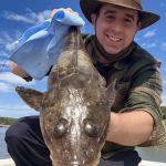
Just wanted to suss out the weedy areas around Mordi / Parkdale for squid & whiting.
Cheers
PPB - Aerial photos
- Andrews
- Rank: Premium Member
- Joined: Mon Oct 07, 2019 2:41 pm
- Location: Bellarine Peninsula
- Has liked: 268 times
- Likes received: 774 times
Re: PPB - Aerial photos
Happy New Years mate!
Great question, hopefully this answer helps!
You're completely right about google maps often lacking in the PPB coastline photos, often this is either cause by lower resolution and/or compression from the depth of water.
Google Earth looked to have the best image quality, link provided for the area!
https://earth.google.com/web/@-37.99633 ... y,0h,0t,0r
Amateur Fisherman, South West Victoria / - Instagram:
https://www.instagram.com/fishingandrew/ Sponsors: Yamashita Australia, Sunline & Gomexus.